View Intelligence Platform · Worldwide

Views Drive Value.
Now They're Verified.

Verified, floor-level panoramic views for every unit. Captured by drone, delivered through an interactive viewer your sales team can share.

✓ Bring your imagery or we capture it (SEQ)
✓ No ongoing fees
✓ Fixed-price proposals
✓ Live within 1–2 business days
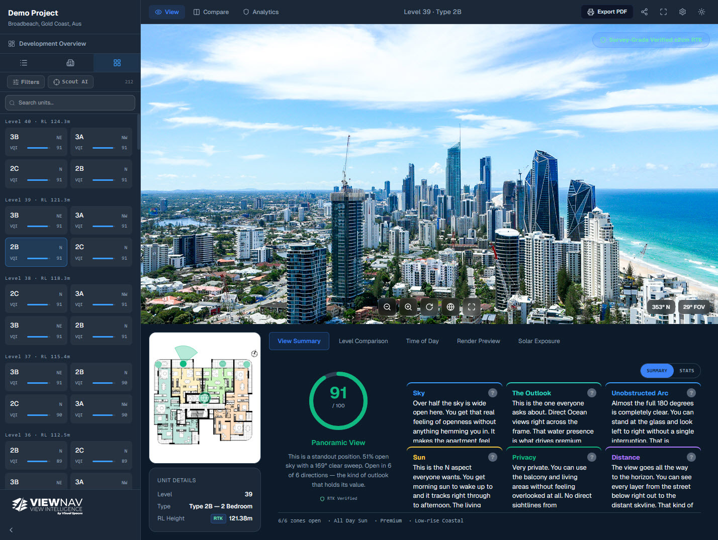
app.viewnav.app / your-site / level-38 / analytics
ViewNav analytics dashboard
Three tiers. One platform.

One Platform. Three components.

Every ViewNav project is built on RTK-verified panoramic capture and an interactive viewer your sales team can share. A third component, AI-powered view analytics, is available as a beta add-on for developers and agents. Capture can be supplied by you or handled by Visual Spaces for SEQ projects.

01 — Onboarding
Drone View Capture

The data standard that powers the platform. Supply RTK-Grade panoramic imagery with EXIF metadata and we build your ViewNav project from it. RTK capture delivers the highest accuracy — available for SEQ projects through Visual Spaces.

  • 180° panoramic per unit
  • 360° panoramic per floor level
  • GPS or RTK positioning accepted
  • EXIF bearing, altitude & GPS metadata required
  • High-resolution JPEG, correct RL per level
  • RTK ±2-5cm capture available for SEQ projects
All project types
03 — Intelligence layerBeta
View AI Analytics

An emerging add-on layer that turns view quality into scored data. Currently in beta.

  • View Quality Index (VQI) per unit
  • Sky, solar, water & privacy scoring
  • Development-wide overview & heatmap
Developers · Planning consultants

Learn more →
The Process

A simple process. Serious data.

1

Capture or Supply

Share your development address, level count, and floor plan. Supply your own RTK-Grade panoramic imagery, or we capture it for you (SEQ) — we'll scope accordingly and provide a fixed-price proposal.

2
RL

We Build Your Project

We process your imagery, configure the viewer and analytics for your development, and verify every floor level against the capture data.

3

Your Platform is Ready

Your ViewNav project is live — a shareable URL with interactive viewer, AI analytics, and embed code ready for your campaign site or sales suite.

ViewNav accepts compliant RTK panoramic imagery from anywhere
SEQ projects captured by Visual Spaces — Gold Coast, Brisbane, Sunshine Coast & surrounds
01 - Onboarding · Capture Standard

Verified from day one — wherever your project is

ViewNav works with any RTK-Grade panoramic imagery that meets the capture spec — floor-level, correct RL elevation, EXIF bearing, altitude and GPS embedded per image. GPS-captured imagery is fully supported. For the highest positional accuracy, RTK capture locks every panorama to a verified real-world coordinate at ±2-5cm — available for SEQ projects through Visual Spaces.

GPS or RTK panoramic imagery accepted
360° panoramic capture per level required
180° panoramic capture per unit required
EXIF bearing, altitude and GPS per image
Correct RL elevation per floor level
RTK ±2-5cm precision capture — Visual Spaces, SEQ
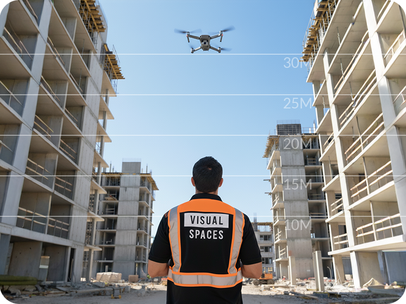
RTK drone capture panoramic view
Based in South East Queensland?
Visual Spaces provides RTK drone capture across the Gold Coast, Brisbane & Sunshine Coast
±2-5cm positional accuracy · Full project in a single site visit · Fixed-price proposals
Get a Capture Quote →
02 · ViewNav Viewer

The only sales tool where the view is verified

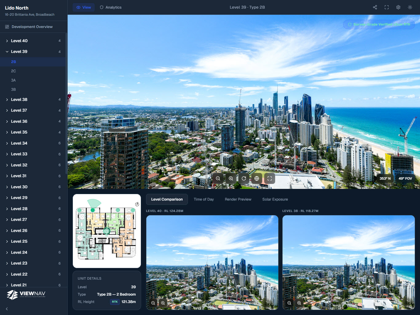
A shareable, embeddable interactive viewer that puts buyers inside the real captured view — at the precise eye-level elevation of each unit. 80% of our clients add the viewer to their drone capture project.

Full 180° interactive panoramic per floor
Side-by-side level comparison for sales conversations
Floor plan overlay with directional viewing cone
Embeddable on any website — no login required
One-time project fee, hosted for the campaign
Your Site · Level 39 · Type 2B
ViewNav interactive panoramic viewer
View AnalyticsBeta

Turn view quality into defensible numbers

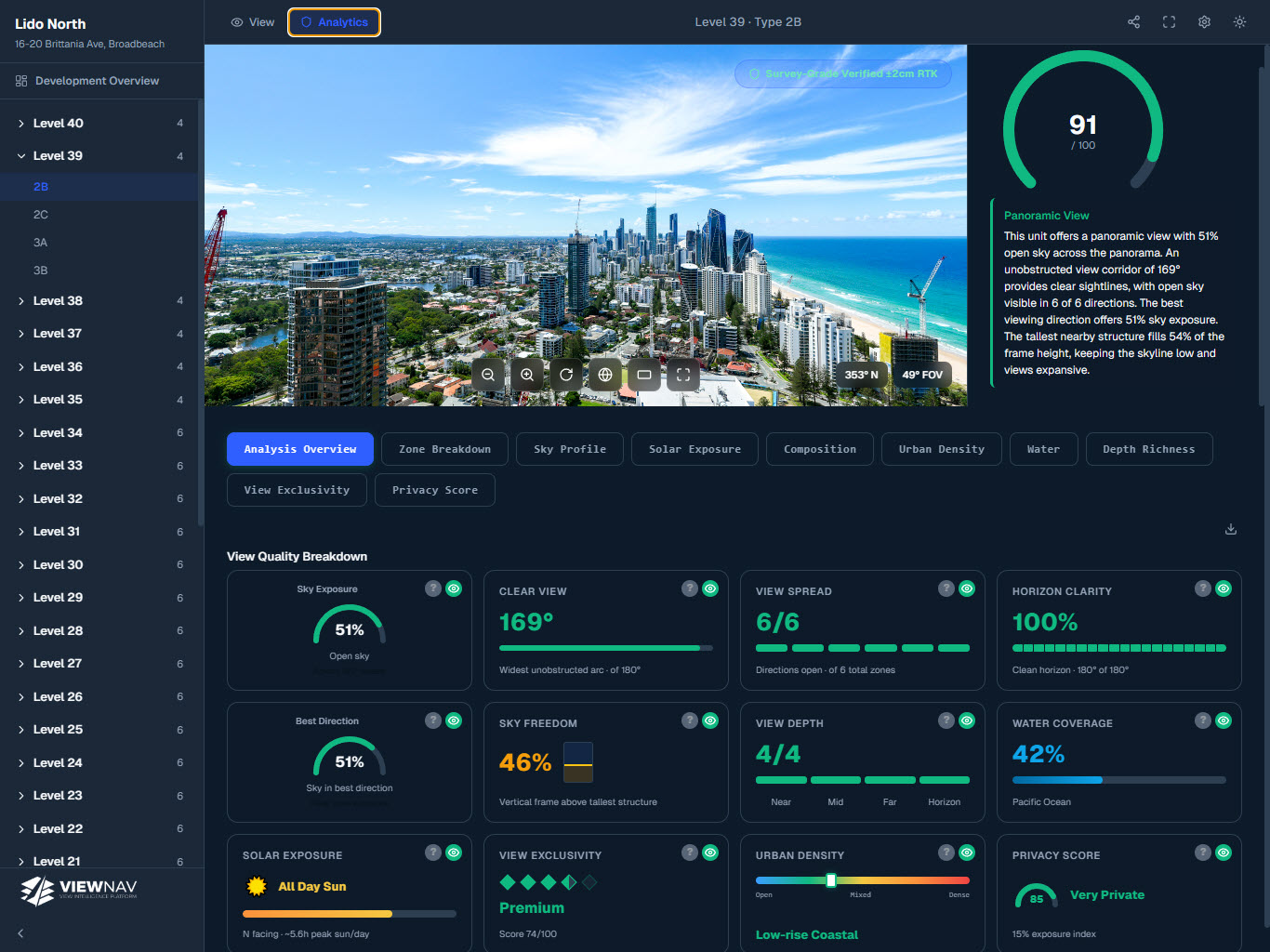
Our analytics layer measures each panorama across multiple view-quality dimensions. Currently in beta.

Explore View AI →
Your Site · Level 38 · Type 2B · Analytics
ViewNav view analytics dashboard
±2-5cm
RTK accuracy · Visual Spaces SEQ capture
80%
Viewer uptake across projects
180°
Panoramic FOV per floor level
1
Site visit, full building captured
100%
Floor coverage — every unit, every level
In the field

Trusted by SEQ's leading developers

Demo Project
Residential Tower
Gold Coast · Multi-level development
ViewNav demo project panoramic view
38Levels
212Units
Explore the viewer →
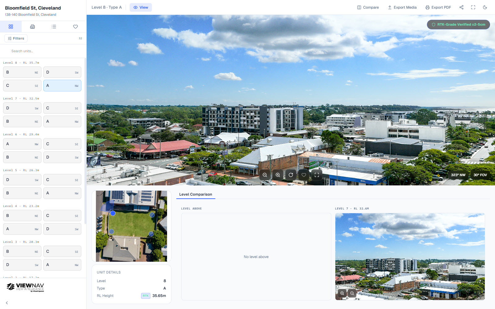
Bloomfield St, Cleveland panoramic view
Bloomfield St, Cleveland
Position Property
Levels8
Units32
View project →
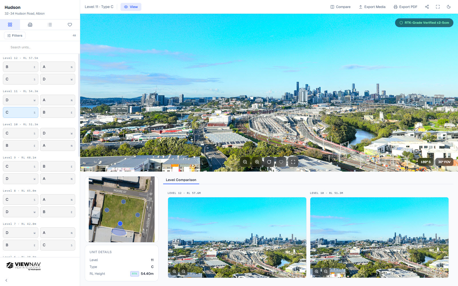
Hudson panoramic view
Hudson
Deluca
Levels12
Units48
View project →
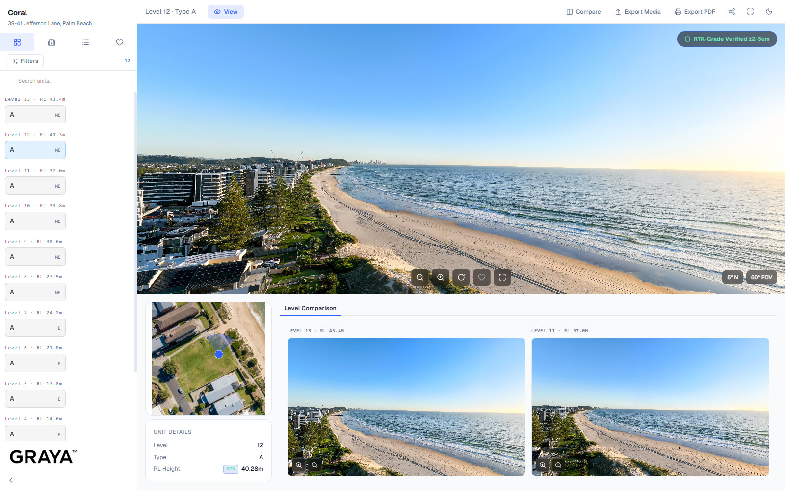
Coral panoramic view
Coral
Graya
Levels12
Units12
View project →
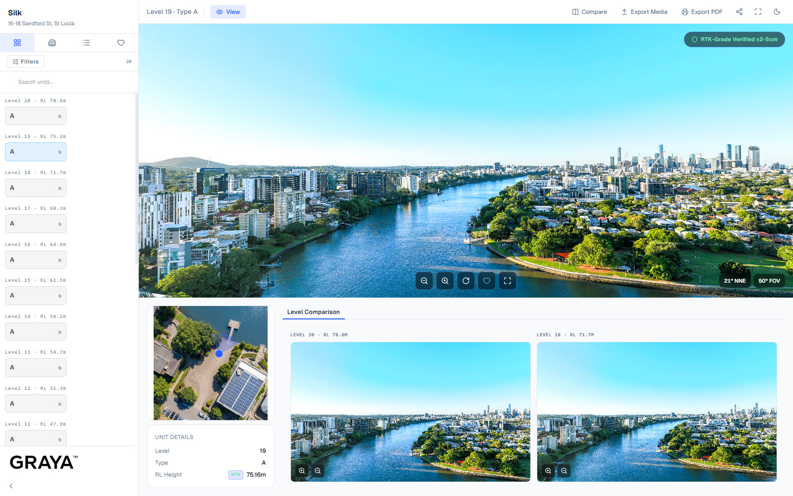
Silk panoramic view
Silk
Graya
Levels20
Units20
View project →
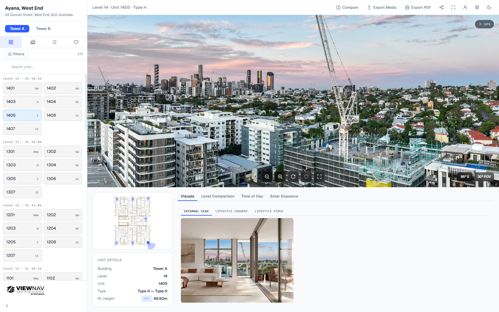
Ayana, West End panoramic view
Ayana, West End
Zen Group
Levels11
Units176
View project →
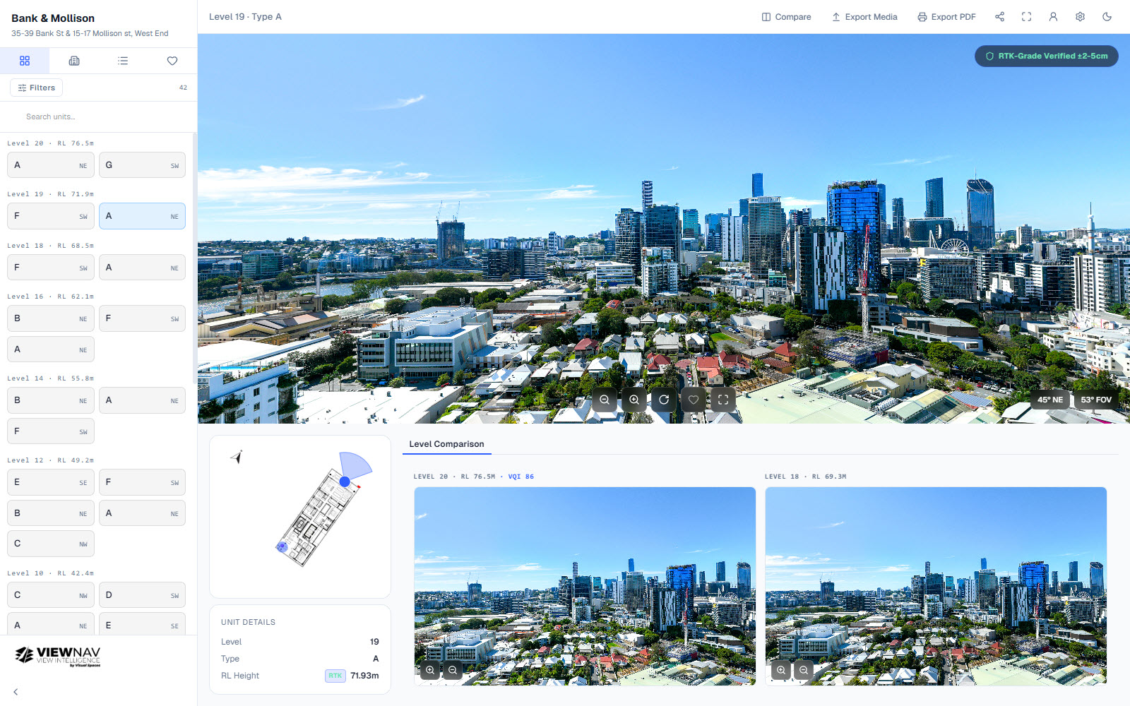
Bank & Mollison panoramic view
Bank & Mollison
Unison Projects
Levels11
Units42
View project →
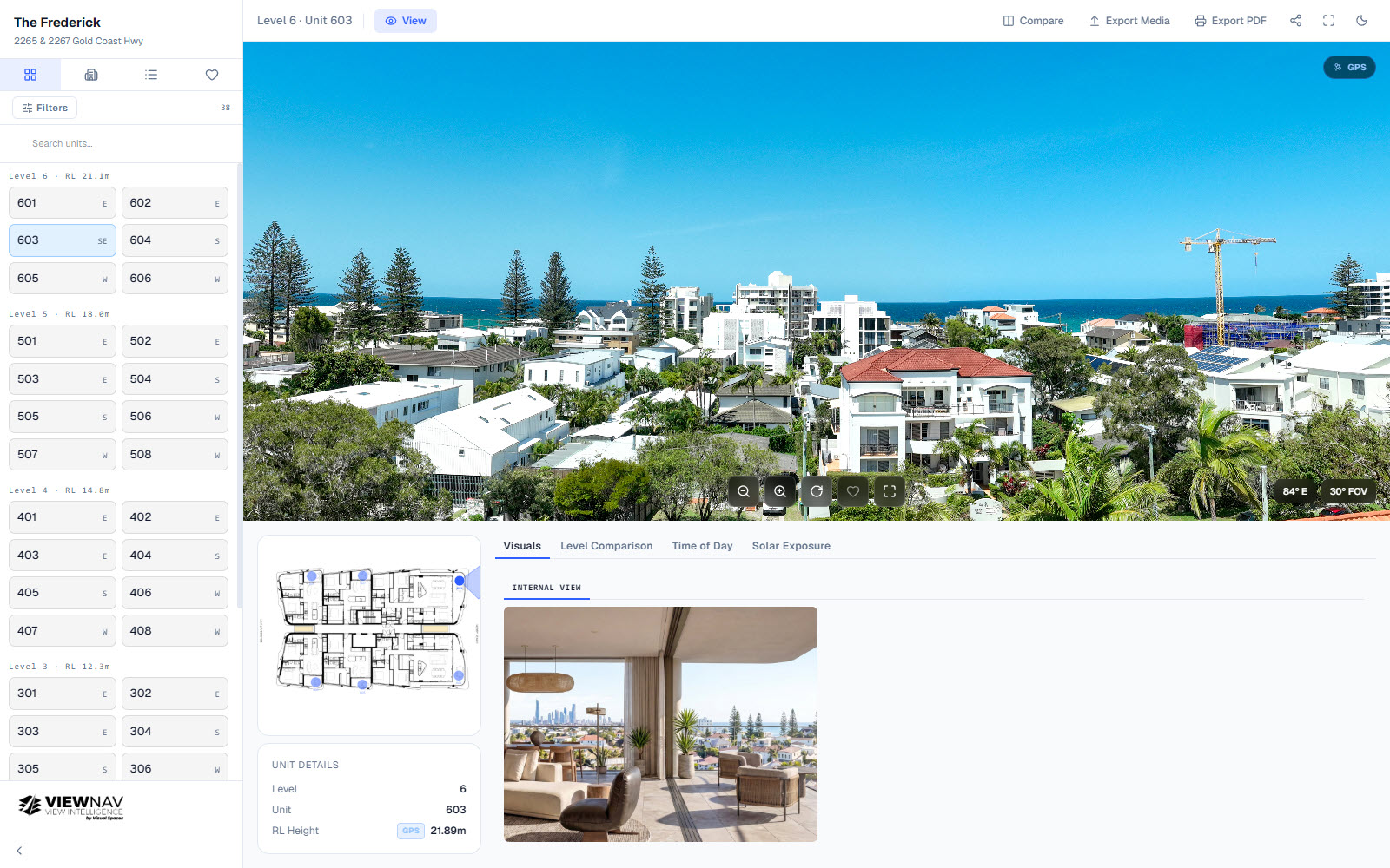
The Frederick panoramic view
The Frederick
Big Projects
Levels6
Units38
View project →
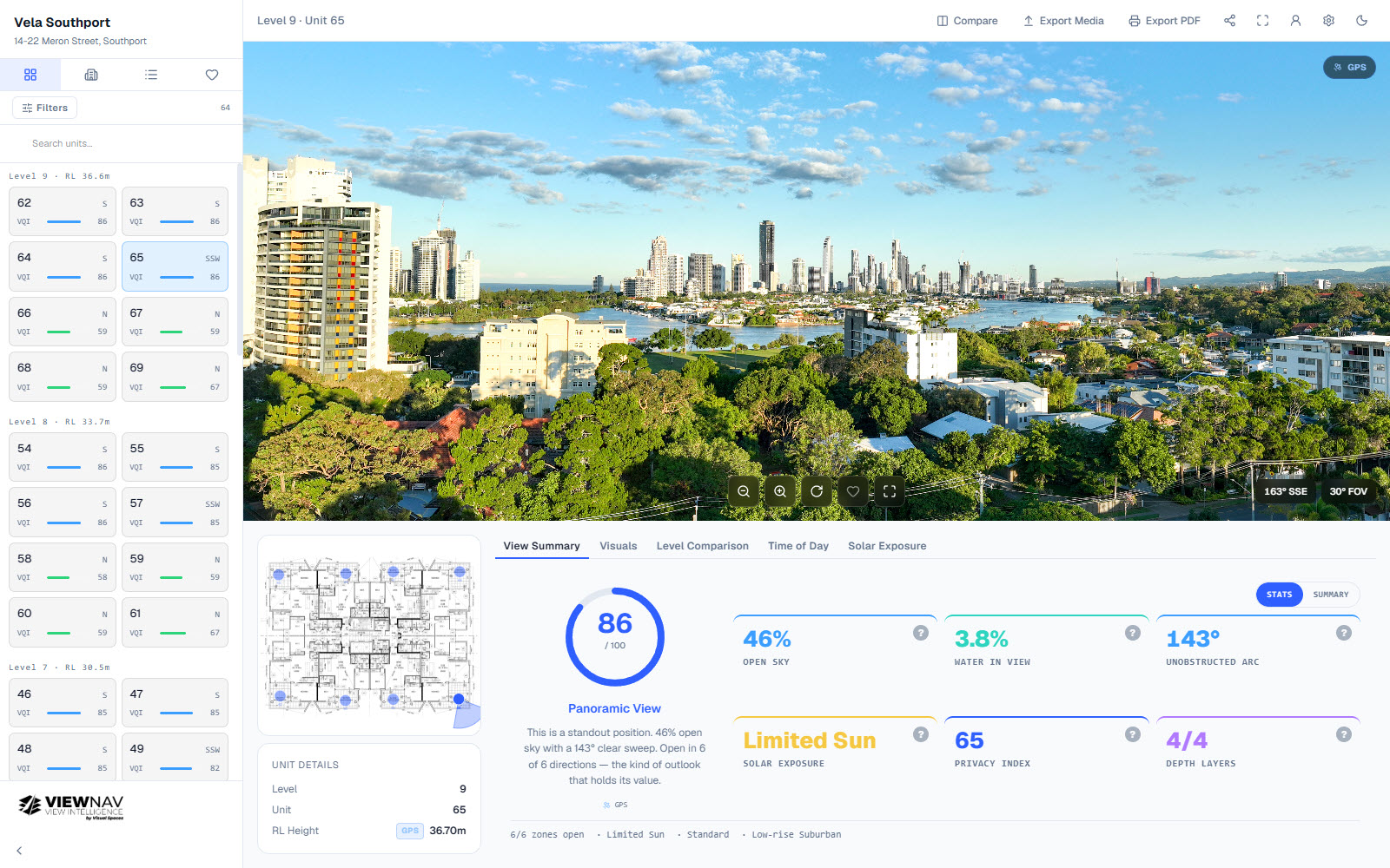
Vela Southport panoramic view
Vela Southport
Zen Group
Levels8
Units64
View project →
Visual Spaces services the South East Queensland (SEQ) region — Gold Coast · Brisbane · Sunshine Coast & surrounds
Add View AI Analytics

Your views have value. Now prove it.

View AI Analytics is added to any ViewNav project as a flat one-time fee — no subscription, no lock-in. Tell us about your development and we'll include it in your proposal.

Email *
Project name
Project address
Levels 10
Units 50
Interested in
Please enter a valid email address.

Fixed-price · No lock-in · Response within 1 business day

✓ Proposal request received — we'll be in touch within 1 business day.